- Walking With Brian
- Jul 28, 2023
- 9 min read
Updated: Aug 6, 2023
Around 6000 years ago, farming practices began in Great Britain. The hunter gatherer lifestyle was replaced by crop rearing and animal husbandry. Wild animals had to be domesticated in order to create the livestock we are familiar with today. The ancestor of modern cattle is considered to be the aurochs, now globally extinct.

Prior to human arrival, Britain was likely covered in a patchwork of grassy plains, shrublands and woodland. It was the ideal habitat for aurochs. They would have wandered the vast, wild landscapes in large herds. Grazing animals permit an array of wildflowers to co-exist by ensuring more boisterous plants don't dominate. The large herbivores nibble at the roots of bushes and young trees, thereby maintaining mosaics of open vegetation. Carcasses would fertilise the soil and provide food for a wide variety of other animals. Cattle dung is a nutrient-rich resource for plant and insect life. All part of a cycle. Human beings disrupted this natural order by taking large areas of land for farming purposes and domesticated livestock was given priority. Wild aurochs survived in Eastern Europe until the early 1600s, when the last known examples died out in the Polish forests. Their DNA imprint lives on in modern breeds such as Highland and Longhorn cattle, which explains why these particular beasts are so hardy. The Chillingham Wild Cattle Centre allows visitors to view the closest living link to the pre-domestic ancestors. Situated in Northumberland near the market town of Wooler, the Chillingham herd has roamed free for many centuries within the confines of the hilly estate. Safe from human interference, the bulls compete naturally for the attention of females, occasionally fighting each other to the death. The herd size is currently 130, equally split between male and female. All sport horns and have never been handled by people. No vet has ever administered treatment, other than humanely dispatch an animal clearly on the way out. No new member has joined the group in over three centuries and as a result the cattle are now completely inbred. There are scientific arguments to say they shouldn't have survived this! We drove down the A1 early on a Saturday morning and passed through Wooler, arriving at the visitors centre shortly thereafter. The estate was broken up in the 1980s and the cattle are now in the hands of a charitable trust. Chillingham Castle - the medieval manor house -functions today as separate concern. The Wild Cattle Visitors centre was constructed in recent years and offers refreshments, toilet facilities and, naturally, a gift shop. Staff are on hand to answer queries and the pre-cattle entertainment was provided by the adorable Teazle. A friendly springer spaniel, she dropped tennis balls at people's feet, hoping to engage them in a game of fetch. A very efficient retriever she was too!

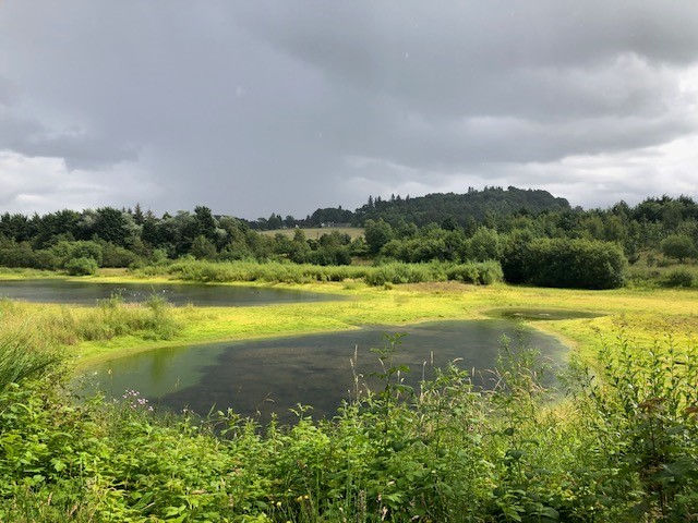
Outside of winter, the centre is open seven days a week and offers four tours per day. Visitors are taken on a trailer ride up to the pasture. Each trip can accommodate a maximum of 20 people. There had been a constant drizzle as we drove down and it was a relief to note the trailer was enclosed by plastic sheeting. Ponchos could be safely stowed in the car. Two women - both fellow birdwatchers - joined our tour and the Land Rover began pulling us up the hillside. The website describes the trailer as "not well sprung" and fortunately the vehicle crawled along in first gear. Upon spotting the cattle (they do move around), the driver / guide pulled over at a field gate and invited us to take a few steps inside. The animals were around 150 yards away and that was as close are we were permitted to go. A large group had clustered together with a few outliers, but the beasts (thankfully) showed little interest in the spectators. A very informative talk was given and guests were invited to ask questions. I already knew about the isolation and inbreeding but hadn't truly appreciated the extent to which the cattle are left to fend for themselves. Struggling calves aren't helped in any way, nor are cows who experience difficulties after (or during) giving birth. The aim is to replicate nature as closely as possible. There is great scientific interest in the herd. Meticulous records have been kept since 1860, at the behest of Charles Darwin no less! A bellow rang out from time to time and I learned the bulls usually live for around 12 years, cows a little longer. Dead animals are retrieved and autopsies sometimes performed by researchers. I was astonished to hear the size of the herd had once dropped to just 13, following a harsh winter. I presume the gene pool was further depleted in subsequent generations. The last world cattle census was taken in 2018 and numbered over a billion beasts, underlining the infinitesimal fraction that the Chillingham contingent represents. The habitat here is a good example of wood pasture - now rare in Europe. A wide variety of plants and wildlife are present, due to the absence of intensive farming. Deer, red squirrels and badgers live within the estate and the bird species include green woodpeckers, buzzards and nuthatch. The guide let slip that a back-up herd exists in an undisclosed Scottish location. Fertility has not declined, perhaps attributable to the strict natural selection environment that applies. The cattle remain remarkably disease free and thankfully the nationwide foot and mouth outbreak in 2001 stopped two miles short of Chillingham Estate. Had a case been confirmed, the entire herd would have faced slaughter.

I found the whole experience fascinating. Domestic cattle are of course ten a penny as you travel around the UK but it was amazing to see a wild herd at close quarters and learn about the genetic links to the past. At just £9 per person, the tour is superb value for money and an absorbing history lesson for anyone interested in British flora and fauna. We drove back to Wooler, the last town of any significant distance from home we had visited before lockdown was announced in March, 2020. Thankfully the High Street was still trading vibrantly, with the independent shops still extant. We purchased lunch from the bakery and popped into the sweet shop. The delicatessen is owned by a German-speaking Scotsman and he remembered us from our previous trip. We selected some local cheeses as he regaled us with tales of his recent visits to the Vaterland. Wooler has just 2000 residents and it didn't take us long to explore the town centre. We then headed out to the coast to observe the birdlife and Budle Bay, one of our regular haunts over the years. Not a great deal was happening today, but it was nice to see a few curlews prodding the sands. Our accommodation for the night was on the Scottish side of the border in Kirk Yetholm. The small village sits at the northern end of the Pennine Way - a challenging 268-mile hillwalking trail that stretches all the way to the Peak District National Park in Derbyshire. Saint Cuthbert's Way also passes through Kirk Yetholm, meaning a steady flow of walkers provides a viable business model for the local hostel. The area is also popular with cyclists. The hostel is owned by Friends of Nature UK and is staffed by volunteer wardens. We managed to book one of the private rooms (which isn't any dearer than two beds in a dorm). Aside from a German family with young children, every guest was over the age of 45, a typical situation for a rural "youth hostel" in the UK. There was a spacious kitchen and lounge. Far more relaxing than my recent stay in a central London bunkhouse, not that you can meaningfully compare the two environments. After a good night's sleep and hearty breakfast, we headed northwards.

I had bought a handy map of the Northumberland 250 at the cattle centre. The 250 is a circular scenic driving route around the county. This type of experience is popular at the moment, with Scotland's North Coast 500 and Ireland's Wild Atlantic Way attracting motorists from all over the world. Route 66 with added rain! We decided to drive a small portion of the Northumberland circuit from Wooler to Berwick, where we could join the A1. It had rained heavily the previous evening and the back roads had surface water in places, but nothing too serious. Onwards we splashed. The map had identified the villages of Ford and Etal as places of interest. I must confess I hadn't heard of either. We turned off the main Coldstream road at the junction for Etal and spotted a brown sign for a heavy horse centre. Interesting, but we were already livestocked out this weekend. Back came the keeper of the brown signs with a better offer - the Heatherslaw Heritage Railway. Ok, now we're talking! I didn't expect to hit the jackpot though. As we pulled into the car-park, a locomotive was sitting in steam, clearly preparing for departure. We swiftly purchased tickets and squeezed into one of the little carriages. Heatherslaw is a 15-inch narrow gauge railway, running alongside the River Till from a mill complex knows as Ford Forge, to Etal, two miles away. Remarkably, the railway was built from scratch as a tourist attraction in the 1980s. I had wrongly assumed it must have industrial roots. A locomotive was commissioned from the Ravenglass & Eskdale Railway in Cumbria, while the six coaches (later increased to 13) were assembled on site. The line began running in 1989 and was extended to its present length in 2004. Over the last decade, a pair of new locomotives has been introduced. Steam-driven Bunty was working the line today, while reserve workhorse Binky runs on diesel. Due to time constraints (and the miserable weather), we decided not to alight at Etal and instead took the same train back to Ford Forge after the engine had changed ends. What an unexpected find!

We wandered over to the working corn mill as Nicole wanted to purchase flour for bread making. We entered the gift shop, but it was also possible to tour the building which has housed the present incarnation of the mill since 1830. Local historians reckon milling has taken place on this site for over 700 years. Closed in 1957, the corn mill was saved from demolition in 1972 and placed in the care of a trust. Opening as museum three years later, the mill educates visitors about the industrial past of the area as well as producing ten tons of flour every year. The historic Ford & Etal Estates (united in 1908) cover 14000 acres and contain 31 tenant farms. 600 people live within the boundaries and there are many tourist attractions within the two villages and wider grounds. A visitors centre next to the mill outlined the history of the area and provided information leaflets. The ruined Etal Castle was visible from the train ride. Abandoned since 1748, it was sacked in 1514 by the invading army of King James IV of Scotland. This disastrous campaign saw Scotland heavily defeated at the Battle of Flodden. James remains the last British monarch to die in battle, just a couple of miles from where we stood. We had previously visited the battlefield a few years back, on a return trip from England. We will definitely return to Ford & Etal in the future. The area is close enough to the A1 to make it a viable detour when driving south. Up at Berwick, we crossed the border and paused for lunch at the viewpoint. A family were posing for photographs at the sign and Nicole offered to take a group shot. It turned out they were from Germany. Die Welt ist ganz klein! Entering East Lothian, we turned off the main road near Dunbar to follow a coastal loop. We chanced upon a smokehouse and bought some goodies for future consumption. The next stop was at a car park with a fine view of the Bass Rock - a huge volcanic plug with sheer slopes standing two miles offshore. The rock is home to the world's largest Northern gannet colony and can be seen from many points on the Firth of Forth. Passing through North Berwick and Gullane, we pulled over at the premises of the SOC (Scottish Ornithologists Club) in Aberlady. Admission is free to all and there were two exhibitions of bird art on display in the public galleries. The woman behind the counter suggested we stop at Musselburgh Scrapes on the way home. Five new hides have recently opened on this patch of reclaimed land at the point where the River Esk flows into the Forth. The new development has a fully accessible tarmac path encircling the wetlands, pebbled beaches and other habitat within. Fencing and a moat have been installed to keep dogs out of the bird territory. The project has been carved out of the ash lagoons that previously occupied the site and the priority is to attract roosting waders. Public access was only recently granted and the land was gifted to the local council by Scottish Power, who created the lagoon landscape with ash from the now-demolished Cockenzie Power Station.

We joined the Edinburgh bypass, edging ever closer towards home. One mission remained, however. IKEA has a store near Loanhead and we have been regular customers over the years. Nicole wanted to have a look at the computer desks. It's often better to see them built up and actually sit at the furniture before parting with any money. Dropping in around teatime is a risky business though. No matter how much willpower you think you are capable of exerting, the lure of the café is strong and you always find yourself drawn there. I'm a great believer in trying different dishes on the menu of a restaurant you frequent. IKEA is the one exception. It's always a plate of meatball, chips and peas, with a slice of daim cake for dessert. Duly fed and watered, we passed through the emporium downstairs, managing to make just minor purchases. We were home 45 minutes later. A great little weekend trip that the weather tried to dampen, but couldn't. Learning about wildlife and stumbling upon a steam railway. Not bad at all.