top of page
  • Writer: Walking With Brian
    Walking With Brian
  • Dec 5, 2023
  • 4 min read

Updated: Dec 8, 2023

A few months ago, I picked up a leaflet detailing walking trails around the Lanarkshire village of Forth. One route that caught my eye involved an exploration of a historic ironworks. This seemed right up my street and I shoved it on the list. I did the walk on a bright autumn Sunday and the journey took just 45 minutes from Dunfermline. Forth is situated seven miles south of the M8, beyond the West Lothian town of Whitburn. The landscape changed to bleak moorland as I neared my destination. The heritage trail is located near the tiny settlement of Wilsontown on the outskirts of Forth.


Wilsontown today consists of private houses strung either side of a minor road. The surrounding woodland is owned by the Forestry Commission and their car-park has a large map showing the local path network. An old railway embankment parallels the road down to the houses and an access gate allowed me to follow the course of the line to a set of bridge abutments inlaid with an elaborate metal gate. This is the starting point of the ironworks heritage trail and I read the information boards to familiarise myself with the industrial history of the area. The ironworks was founded in 1779 (the first in the county) and continued until 1842, therefore pre-dating the railway I had just walked upon. A workers village was built and two thousand people lived here during the peak years. This combination of workplace and residential homes squeezed into a small rural valley makes Wilsontown particularly interesting from a social history perspective and the place was certainly a forerunner in the Scottish industrial revolution. All the necessary raw materials were mined close at hand: ironstone for the metal ore, coal to fuel the furnace and limestone for purification purposes. The operation was started by three Wilson brothers - John, Robert and William - who had business contacts in London that helped raised the necessary capital. As is often the case with groundbreaking schemes with no established road map to follow, the first incarnation of Wilsontown (see what the brothers did there) was not a long-term success, but the foundations of the modern industry were laid. The development of the hot blast furnace was perhaps the most significant step towards making the production of iron more commercially viable. Engineer James Beaumont Neilson (1792-1865) inadvertently discovered this process at Wilsontown in 1828, while fixing a leaky water tank. He realised the fuel efficiency of the furnace could be improved by fanning it with hot air rather than cold. The current was blown through a heated vessel. Neilson's discovery reduced consumption by a third, enabling raw coal to be used instead of expensive processed coke. It also triggered the exploitation of black band ironstone, the use of which had previously proved unprofitable. Neilson secured patents and became a wealthy man, shrewdly setting the initial licensing rates at a modest level in order to discourage evasion. This meant the royalties took a while to accumulate but they eventually reached a sizeable amount due to a thirst for iron in the shipbuilding and railway industries.


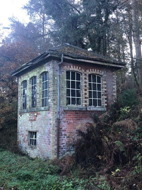
After the Wilson brothers departed in 1812, other oweners tried to make a success of the ironworks, but failed. The lack of a rail connection to Wilsontown meant that produce had to be transported locally by horse-drawn waggonway, then by road to Leith for onward export. This state of affairs placed a serious constraint on the continuing viability of the project and when a mineral line finally arrived in 1860, the works had already been demolished a decade and a half beforehand. In a twist of fate, the type of iron produced at Wilsontown was the ideal sort for railway engineering. Coal mining had now taken over as the dominant local concern and lasted until 1955 (opencast continues to this day). Some of the original workers' housing was still occupied in the 1930s. I followed the trail, looking into the barren shallow valley of the Mouse Water that had once been a hive of industrial activity. The last surviving ruins were reduced to their foundations by the Forestry Commission in 1974 following safety concerns, although this proved a controversial move as the site had recently been designated a scheduled ancient monument. The structures included the remains of two engine houses, a limekiln and a three-arched waggonway bridge. A display of vintage postcards at the entrance gate showed this lost heritage. Further along the walkway, one building seems to have escaped the wrecking ball. The village inn was constructed in 1806 and is now a roofless shell. Standing alone upon the moor, the old hostelry is a fascinating relic from the past. The trail looped around an area now cleared of trees. Commercial forestry came to the area in 1970 and the land around the ironworks was planted with conifers. When this plantation was removed in 2008, it exposed the obvious traces of bell pits on the landscape. From the top corner of the circuit, I could easily pick out the bumps on the earth that showed where ironstone had once been mined. The pits were hand dug and the mineral was found in large balls weighing up to a ton. They then had to be manhandled up a ladder to the surface.


I finished the loop and walked along the railway trackbed back to the car. Passenger trains stopped at Wilsontown between 1867 and 1951, with the terminus also including Forth within its catchment area. The branch split from the present day West Coast Main Line at Auchengray (this station closed in 1966) and the tracks continued beyond Wilsontown to serve various coal pits. Freight traffic ceased in 1964 and the line was lifted. It had been a very informative day out and I had learned more about Scotland's social and economic past. I drove into the centre of Forth for a quick look around. On the road back to Whitburn, I passed Breich Railway Station, situated on one of the four lines that links Edinburgh and Glasgow. The surrounding area was once highly industrialised but is now firmly rural. Breich regulary features in the list of least-used train halts in Scotland. Closure, however, would be a political hot potato.


  • Writer: Walking With Brian
    Walking With Brian
  • Nov 30, 2023
  • 3 min read

Updated: Dec 6, 2023

My wife Nicole started birdwatching a few years ago and has rapidly ascended to an advanced level. I have made more relaxed inroads to the world of our feathered friends. In the beginning, it was all about the photography aspect for me. Gradually, I began to accumulate knowledge and enjoy observing the birds going about their business. I could now be classed as a part-time enthusiast. The hobby often involves an interesting walk and the chance to learn new historical facts about the surrounding area. What's not to like?


One of Nicole's birding buddies is a member of the Scottish Ornithologists Club Clyde branch and they had an outing to Musselburgh Lagoons planned. Craig assured us we could come along as the trips are open to all and we found ourselves heading across the Firth of Forth on a Saturday morning. The SOC was established in 1936 and exists to promote the study, enjoyment and conservation of wild birds and their habitats across the country. The headquarters are at Waterston House, Aberlady and we had previously visited this resource centre on a couple of occasions. Regular public exhibitions are held and there is also a library and shop on site. A small core of paid staff deal with the club administration but the vast majority of tasks are carried out by volunteers. There is also a social side and an extensive programme of talks, workshops and field trips is offered across the 15 regional branches. The current membership stands at over 3500 and today would be our first ever interaction with a bird club event. We met up with Craig in the lagoons car park and around 40 people were present. Organiser David Palmar outlined the plan for the day and branch chairman Zul Bhatia (originally from Tanzania) welcomed everyone. We made our way round to the sea wall, overlooking the choppy estuary and scopes were hastily assembled on the elevated path. It was immediately apparent that a wide spread of birding experience existed within the group. I had assumed I would be dwarfed knowledge-wise by SOC members but quite a few were at a lower-intermediate level, like me. David Palmar certainly knew his seabirds, but stressed there is no such thing as a silly question and that everyone starts out as a beginner. The overwhelming mood was a welcoming one. For some people, the attraction will be meeting like-minded people in pleasant surroundings, rather than acquiring the ability to instantly identify a red-throated diver half a mile away. Great crested grebes aren't an uncommon sight around these parts and a few were bobbing on the waves. They perform elaborate courtship displays during the breeding season and young chicks can often be seen riding on their parents' backs. Of greater interest was the presence of long-tailed ducks. They often spend the winter here and live on mussels, crabs and small fish. As with many ducks, the male has the more spectacular plumage. The plainer female is pictured above, along with a grebe. Further out in the sea, group members spotted exotic Slavonian grebes and velvet scoters.


Our party then moved round to the lagoons where extensive landscaping has taken place in recent years. Five new hides have been constructed. Land reclamation has been happening in the general area (known as Levenhall Links) for decades, using waste ash from the now-demolished Cockenzie power station. The new wetland is encircled by a tarmac path and the fencing has been designed to keep loose dogs out. A moat adds an extra layer of security in this respect. The hides are basic roofless brick affairs and hopefully more or less vandal proof, a necessary concern when a reserve borders an urban settlement. There are islands, pebbled beaches, a wall for sand martins and pools of varying depths. This whole mosaic should provide a wealth of nesting and roosting opportunities for a wide variety of birds. Oystercatchers, curlews and godwits were well represented today. We trooped back to the car-park for a packed lunch by the boating pond and the final activity was a short wander along to another patch of wetland. Here we observed snipe and it was a nice end to an interesting day. A pleasant group of people.


  • Writer: Walking With Brian
    Walking With Brian
  • Nov 16, 2023
  • 7 min read

Updated: Dec 5, 2023

The newbie cities of Dunfermline and Stirling were once linked by a mainline railway. Passenger services ceased in 1968 and the last freight train ran in 1986. Nowadays the old trackbed hosts an 11-mile walking and cycling path with a tarmac surface. This rural artery runs from the Western edge of Dunfermline to the fringes of Clackmannan, whereupon new rails take over (more of which later). As a public transport enthusiast, it's a personal bone of contention that there's not even a direct bus service between Dunfermline and Stirling - two places with city charters, a shade over 20 miles apart. Surely this corridor is a prime example of low-hanging fruit in terms of building a greener travel network.


The cycleway was constructed sometime in the 90s. I definitely rode the entire length in 1999 and walked a portion a few years beforehand. Since moving to Cairneyhill, I have traversed the old railway on many occasions, including the full distance on foot two or three times. Prior to styling myself as a walker, the path formed a project that I split into several manageable chunks. Back then I merely wanted to explore the infrastructure and approached the task with my train hat on, never giving a moment's thought to one day tackling the 11 miles in one go. That in itself illustrates how far I have progressed on my two-legged journey. Autumn is an ideal time to visit. The broadleaf trees display their fabulous colours and the temperature is cool. The firm flat surface is easily accessible and you can do the walk in a comfortable pair of trainers. I set off on a Sunday morning in early November and took the bus through to Clackmannan. I crossed the working single-track line that passes through the town today. A station was located at this point but it closed as far back as 1930. This eastern end of this railway originates near Dunfermline City Station and it runs right through the derelict site of Longannet Power Station (closed 2016) before reaching the small towns Kincardine and Clackmannan. The track formerly joined the trunk Dunfermline & Stirling route on the outskirts of Alloa. Passenger numbers via Kincardine were always low and were scrapped in 1930 but the line was retained for goods traffic. Spanish train manufacturer Talgo was set to move into Longannet but the development - announced in 2018 - appears to have hit the skids. The existing rail connection had been an obvious selling point initially. A failure to secure lucrative HS2 contracts is being touted as the reason for the apparent withdrawal. Part of the package involved extending the Stirling to Alloa passenger service (re-opened 2008) as far as Kincardine. Wider proposals to use the corridor as a direct Dunfermline to Glasgow link are still at the talking stage. The original mainline formation took a more direct inland route from Dunfermline Upper (demolished 1990) towards Alloa and grazed the edge of Clackmannan.


The above diagram shows the principal line from Dunfermline Upper running through the centre. My walking trail for today. This connection was fully operational by 1852. The second (and slower) route from Dunfermline Lower (now City) hugs the coast and was built in two stages 13 years apart, hence the different colours on the map.


I wandered down to join the cycleway at the point where Clackmannan Road Station was situated. It closed as early as 1921, probably because the other line offered a more central option. I set foot on the tarmac and almost immediately crossed a viaduct over the Black Devon River. Mineral lines and tramways diverged here to serve coal pits and a tile works. In the opposite direction, the overgrown embankment continues for half a mile towards the place where the two westward routes from Dunfermline merged (confusingly called Kincardine Junction). A surviving trackside industrial landmark is the tall chimney upon the site of Cherryton Brickworks - opened in 1935. The plant closed without warning in 1976, apparently with a full order book. Almost 30,000 bricks were being churned out daily at the time of the demise and modern machinery was lending a hand. Freight trains were able to reverse into the yard and waste material from nearby collieries was a vital ingredient in the production process. The post-war social housing boom created a huge demand for bricks. The remains of the Cherryton kilns and outbuildings can be found in the undergrowth but I pressed onwards and soon crossed the A977. This marked the site of Forest Mill Station, originally known as Kincardine & Kennet, despite lying three miles from the former. A name change was enforced when Kincardine received a more suitable station in 1893. The trackbed broadened out in front of me, indicating the one-time presence of sidings. Indeed, Forest Mill handled goods until 1979. Passenger trains last stopped here in 1930, a year when many halts across the land were axed due to poor patronage.


The trail passed through Slack Wood and crossed the Clackmannanshire Fife boundary at a minor road overbridge. The remains of a loading bank can be spotted by the trained eye here. Most likely it was used to transfer agricultural produce. A derelict cottage stands close to the trackbed and tucked out of sight around a bend is the A-listed Brucefield House. The surrounding estate encompasses over 400 acres and three luxury eco-bothies are available to hire, along with Slackbrae Cottage. A long straight section of path brought me to the site of Bogside Station. The signal box and wooden waiting room building survive but are showing signs of wear and tear after decades of exposure to the elements and lack of care and maintenance. The waiting room is now almost completely engulfed by vegetation. It's nice to see old station infrastructure feature on the trail and I hope the Bogside buildings remain for years to come. The signal box ceased to function in 1973 when the (freight-only) line was singled. It would make an excellent little heritage centre today. The line was pared back to this point from Kincardine Junction in 1979, thus severing the direct link between Dunfermline and Stirling along the original high-speed course. Bogside Station had closed to passengers back in 1958 but gunpowder traffic to the Muirside explosives depot continued into the early 80s. There was also a short mineral spur leading to Bogside Mine, one of several West Fife collieries feeding Longannet Power Station. An underground network of conveyor belts was eventually developed to transport coal directly to the furnace. The mine was abandoned in 1987, following flooding and gas issues that had built up during the bitter national miners' strike a few years beforehand. Bogside as a settlement is little more than a hamlet and I was very much in rural territory. As I skirted the northern edge of Devilla Forest, I met someone riding a horse along the path. The next halt on the line was East Grange but all traces of the platforms have vanished. A small goods yard was located here and - like Bogside - passenger services disappeared in 1958. Perhaps footfall was deemed viable in Victorian times when far more people worked on the land. The station master's house still exists as a private residence. The path ran through a lengthy cutting and brought me to the eight-arch Dean Viaduct - the most complex piece of engineering on the entire route. The decking is now tarred and I looked down into the wooded gorge below. The short branch to Blairhall Colliery is now a footpath. This pit closed in 1969 but nearby Comrie continued producing coal until 1986.


As I approached the site of Oakley Station, the presence of brick retaining walls and the widening of the trackbed provided clues of former activity. Passenger trains ran until 1968 and a signal box controlled the junction for Comrie Colliery. The system was rationalised in 1982 when the westward rails to Bogside were lifted and Comrie became the end destination from Dunfermline. The showpiece pit had opened in 1939 and featured all the latest engineering wizardry underground. Surface facilities included a smokeless fuel plant and an aerial ropeway to the bing. By the 1980s. three quarters of the mine's output was sold directly to the electricity board. One has to wonder if the government forced the eventual closure out of sheer spite, following the lengthy industrial dispute that polarised society. The decaying rump of a once-grand railway now had no use and the remaining track was removed all the way back to the junction with the present-day Fife Circle line at Dunfermline Queen Margaret Station. Oakley village grew in conjunction with the coming of heavy industry to West Fife and is the only lineside settlement of any real size between Dunfermline and Clackmannan. Therefore the station survived until the final withdrawal of passenger services. I now had three and a half miles ahead of me to the end of the cycle path. It was a pleasant wander between fields on a slight uphill gradient. The walkway comes to an end at William Street on the edge of Dunfermline. A mineral railway system diverged a little further back and ran out to Kelty, Steelend, Lochore and onwards to Thornton. The William Street bridge was dismantled in the late 80s and cyclists and pedestrians must descend to pavement level. This is a pity as the embankment does continue beyond private property on the opposite side and runs another half mile to the Buffies Brae viaduct near the city centre. Although it's not difficult to find an access point on foot, this final stretch now resembles a jungle in places and is an increasingly awkward explore. Apparently SusTrans purchased the land for £1 but the upgrade costs will be high and the logisitics difficult. Beyond the disused footbridge at Phoenix Lane, a few houses adjacent to the line appear to have snaffled parts of the trackbed as garden extensions. Naughty! There is no public access to the viaduct at Buffies Brae, although yours truly has been up there a couple of times. It is possible to leap across the Baldrige Burn and scramble up a very steep slope on hands and knees.


Beyond the viaduct, the rails ran through a deep narrow cutting (now infilled) towards the site of Dunfermline Upper Station, pictured above shortly before demolition. A retail park was built here in the early 90s and put a permanent obstacle in the way of the route ever re-opening. Beyond the football stadium (rear of picture), the walking path continues along to Queen Margaret Station, site of the old junction. A triangular set-up allowed easy access between the Upper and Lower (now City) stations. Closing the Stirling line would be unfathomable in today's political climate. Sadly in the 60s, it was a different story altogether.


The track between Longannet and Stirling had been quietly decaying since the early 1980s as opencast coal was brought in from the opposite direction. The return of passenger trains on the Stirling to Alloa portion in 2008 also included a renewed freight link to the power station in order to remove coal trains from the Forth Bridge. Scotland had switched to importing coal via the deep-water port at Hunterston, Ayrshire. It made sense to convey this traffic via Stirling, avoiding the busy Forth Bridge (not to mention the complex reversing arrangements that followed). We now have rails in place all the way between our two ancient royal capitals, theoretically ready to go. Will they ever reach their potential?


bottom of page